Volcanic action
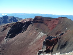
Just done the Tongariro Crossing and feeling very pleased about it. We have t-shirts to prove it too, and a funny-looking certificate courtesy of the lodge that arranged transport and food. The Tongariro Crossing is known as one of the best day walks to the New Zealanders who are so fond of walking. It involved 7 hours of walking, scrambling and low-level climbing in the hot autumn sun through the gap between Mount Tongariro and Ngauruhoe and round Tongariro's middle. This is proof of our presence on the mountainside, a picture of Quintin, Nick and Amani mid-trek:
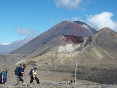
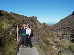
We walked up and down the mountain range nose-to-nose with about 2000 other hikers but this did not tarnish the experience. Ngauruhoe is a stunning, near perfect volcano shape and streaked with beautiful black and red scoria. Tongariro blew its top off completely many, many years ago and you can tramp through its craters - red rock or filled with turquoise and emerald mineral lakes - before descending past the solidified remains of previous lava flows into the bush. We got a few scrapes, swollen limbs, blisters and stupid Lord of the Rings photos but I think we all loved it. A good way to celebrate Nick's birthday. And a pretty spectacular way to introduce Amani to hiking, although maybe not quite as spectacular as the swollen hand she was sporting at the end of the day. Here's me and Amani before our first big ascent. We are smiling and happy but we've yet to see the state of the track ahead:
I've never been to a truly volvanic place before and it's an odd feeling walking through such a sublime, alien landscape. There's evidence of geological change everywhere in this region of Taupo (pronounced Toe-paw in Maori - we've been getting lessons from Dan), but I had no idea how constantly this environment is changing now with landslides, road washouts, river swells, mini-eruptions, new hot water springs occuring here and there as the great tectonic plates shift under the earth.
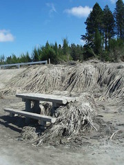
Ruapehu, the big man of the three volcanos in the range at about 2700m, last erupted in the mid nineties. Just a week ago, the latest and long awaited lahar slid its way down the mountainside bringing its torrent of mud and slime. The last lahar in 1953 took out a local railway bridge just as the Christmas Eve train was crossing and 150 people were killed. Police have been stationed in the area for two years, unable to move more than ten minutes from the predicted sight of this last lahar to manage any catastophe caused by its occurence. They did not want a repeat of the Tangiwai Bridge disaster, one of the most remembered disasters in New Zealand's history along with the eruption in the l880s of Mount Tarawera which buried one village and swallowed two others entirely. The lahar seems to have done exactly what it was predicted to do which greatly pleased all the scientists involved in the contingency management programme. The day after our great trek, aching and whimpering a little, we went to visit the memorial to the 1953 disaster at the Tangiwai railway bridge. The lahar had blasted through this site, as if it was retracing the steps of its ancestor lahar. It had covered the area with grey silt and muck, obscuring picnic benches set up for visiting tourists and covering the monument itself although this has been given a swift clean by locals. Here's a picture:
Dan keeps joking that we need a little earthquake or two to get the full New Zealand experience. We missed one in Aukland a few weeks ago and on Tarkaka Hill in the South Island where friends Sara and Garret live. I'd quite like to keep my experiences of spectacular geological activity to the simulations and exhibits we've seen at the museums in Rotorua, Wairoa (the buried village site) and at Te Papa in Wellington. Excellent museums every one of them and more than enough of a taste of geological meltdown for me. And I aboslutely do not need to see an eruption. This is how I like my geothermal attractions, relatively tranquil and beautiful:

More photos, of course, on flickr....

0 Comments:
Post a Comment
<< Home